You can
read the
introduction here, which lists everywhere we stayed in
Belize and every service we used, with links, and can easily be
used to put together your own itinerary.
Part one of the
travelogue is about our arrival in Belize and first days in
Hopkins.
Part two is about
our motorcycle ride to San Ignacio and visits to St.
Herman's Cave and the interior blue hole.
Caracol
We were going to the ancient Mayan site of Caracol! We got up
at 7ish, per my whining the day before that I wanted to sleep in,
we had a way-too-leisurely breakfast at the restaurant at the
Midas Resort, and we didn't
hit the road until almost 9:30 a.m.
I'm going to offer some advice now, for any motorcycle riders who
want to go to Caracol:
- Hit the road from San Ignacio by 8:30 a.m., at the very
latest. 8 would be better, and any earlier would be even
better. It's 85 km to Caracol from San Ignacio, and it took us
two and a half hours on the Honda 150s - it would take more
experienced riders two hours. Most of the road is still
unpaved and some of it is REALLY difficult - and the road
conditions change regularly because of weather and
construction. And, quite frankly, once the road is fully
paved, you will want to be at Caracol before the crowds -
there are no crowds now, at all, but once that road is done,
there will be huge crowds, including day trippers from cruise
ships.
- You have to sign in at the military checkpoint well before
the entrance to the site and you have to leave Caracol by 3
p.m. Budget time for both activities. It's another reason to
go early.
- If it rains while you are on the road, you have to decide if
you are going to push on to the site or turn back. When you
see the unpaved part of the road, you will see why I say this:
the road would be absolutely impassible on motorcycles or by a
4 X 4 after heavy rains. In heavy rain, this road is soup.
It's mudslides. It's impassable.
- Take as much drinking water as you can carry, as well as
snacks - there's no where to get food along the way nor in the
park. We took Stefan's bag, and my purse, and we filled both
with some snacks and a lot of water bottles we filled at the
hotel before we left, along with some pants to change into.
Absolutely, as of February 2023, you need a 4 X 4 or off road
motorcycles to get to Caracol, and I predict it's going to be that
way for at least the next two years, through 2024, and probably
through 2025. The road starts off paved, then turns into a very
nicely formed flat gravel and firm dirt road, and then... NOT! It
has very narrow places, places with deep ruts that will bottom out
a passenger car or mini van, spots where you will get stuck
without four-wheel drive, and whatever hazards have results from
the road construction. There are still many stretches where you
get to experience the original logging road conditions.
When the best part of the road, ends, there is NOTHING along the
way - no ranches, no services, no resorts, no nothing. And the
last few kilometers before the entrance are supposedly paved - HA!
That last stretch was some of the most difficult part of the trip:
it's a very narrow road full of pot holes, and the remaining
pavement is broken and makes the journey quite treacherous.
And after all those warnings and cautions, I have to say:
it
was incredible to ride! This is the first time I've ever
ridden that far off-road before. On my KLR, I would have been a
mess. Even if it hadn't rained, I couldn't have done it on my KLR.
But on that Honda 150, it was absolute doable by me, the forever
novice - challenging, exciting, but doable. I never panicked on a
hill or a turn going up a hill - I was nervous, I might say "eek"
in my helmet, but I never panicked. I nimbly maneuvered around
most hazards. I could stop in places I could never stop on my KLR
to figure out a line or take a break. Was I scared? Yes! But I was
also getting pumped up with each obstacle conquered. So THIS is
why people like lighter bikes. Wow!
We came from San Ignacio through the village of San Antonio, which
was picturesque and, had we had more time, I would have liked to
ride just to there to have a walk around. There's a Mayan women's
cooperative there that welcomes visitors, but you have to have
reservations in advance.
The road to Caracol definitely fooled us at first since the first
part of the road is newly paved and beautiful. After the pavement
ends, the road is still well developed, and at one point, you are
high in pines on a well packed dirt road, and if you couldn't see
the jungle down below, you might think you were in Oregon. We
passed some construction crews, and they never stopped working -
they just waved us right through. At one point,
we
were riding on the sliver of side road next to the graded road,
and then passed the bulldozer grading the road. I was very glad to
have that hard packed sliver and not have to ride on that loose
dirt.
A lot of the ride to Caracol is going through the Mountain Pine
Ridge Forest Reserve. If you zoom in on an online map, you will
see pools and falls and a cave that are open to the public. But
there were no signs for such that we saw on the road. Zoom in on
the area via Google Maps and you will see them. But I get the
impression it's best to go with someone that's been before or a
guide if you want to do that, and it's a separate trip from going
to Caracol - not unless you spend only maybe 30 minutes at
Caracol. Which would be stupid. As the road starts to become more
hilly, you will pass the forest reserve office in the thick of
your jungle ride - don't get confused and think that's the
military checkpoint where you need to stop.
As we passed the forest reserve office, it started to rain. It
wasn't drenching, but it was significant rain. We had seen breaks
in the clouds, but had no idea if those breaks were coming our
way. We were about half way in. There was no guarantee we could
get back any more than there was we could go on. We stopped,
talked, and decided to keep going. I started imagining us having
to stay in Caracol for the night - maybe there would be a house
there for staff? Could I sleep in a hammock? Because no way do
people come in daily to work there from San Antonio, not on this
road, so there had to be somewhere to house us for a night.
Just when I was thinking the road was not going to stay firm
anymore or was going to become too slick to ride, the rain
stopped. Hurrah! The road remained a challenge though - lots of
hills and ruts here and there.
We then came to a large opening in the jungle - it was a compound,
but there were no people that we could see. I"m not sure I even
saw any vehicles. We came to an intersection, and there was a
little hut next to it. That is the military checkpoint. This is a
military base. I would have missed it if Stefan wasn't there - it
was just an open sided hut. We walked up and inside, expecting to
have to answer questions, show ID, etc. Nah - just signed into a
notebook with a large machine gun laying next to it - the guard
was seated, watching something on his phone (it has a lot of
gunfire and screaming), and I'm not sure he even looked at us.
There were 25 visitors at the site already, according to the log
book. I wondered if we were the last ones for the day - it was
already 10:35 a.m., and no one had signed in for an hour before
us. We had at least an hour more of riding to make the entrance.
What's with the military checkpoint? Welp, years ago, there was a
problem with Guatemalan bandits coming over the border and robbing
tourists and researchers going to or from the site, as well as
loggers. In years past, tourists all had to gather at the military
checkpoint and leave together from that point at 9:30 a.m. with a
military escort. They then all had to leave Caracol together at 2
p.m.
The
sign that declares this is still onsite at Caracol. And we
heard that, if you get to the military checkpoint at 1 or later,
headed for Caracol, they won't let you go on.
The road got particularly challenging after the checkpoint: lots
of steeper hills, lots of narrow places, lots of washed out
places. I was so hoping it hadn't rained much and that it wouldn't
rain again. This was the hardest part of the road for me, with all
these hills and more challenging conditions. At last, we came to
what many guidebooks and online sites said was the "paved" part of
the road before Caracol, and, wow, it was some of the hardest to
navigate: it's very narrow, there was substantial overgrowth on
either side of the road when we were there, and the road was more
endless potholes than pavement. Use caution! But at least once you
get to all that broken pavement, you know you are close to the
site.
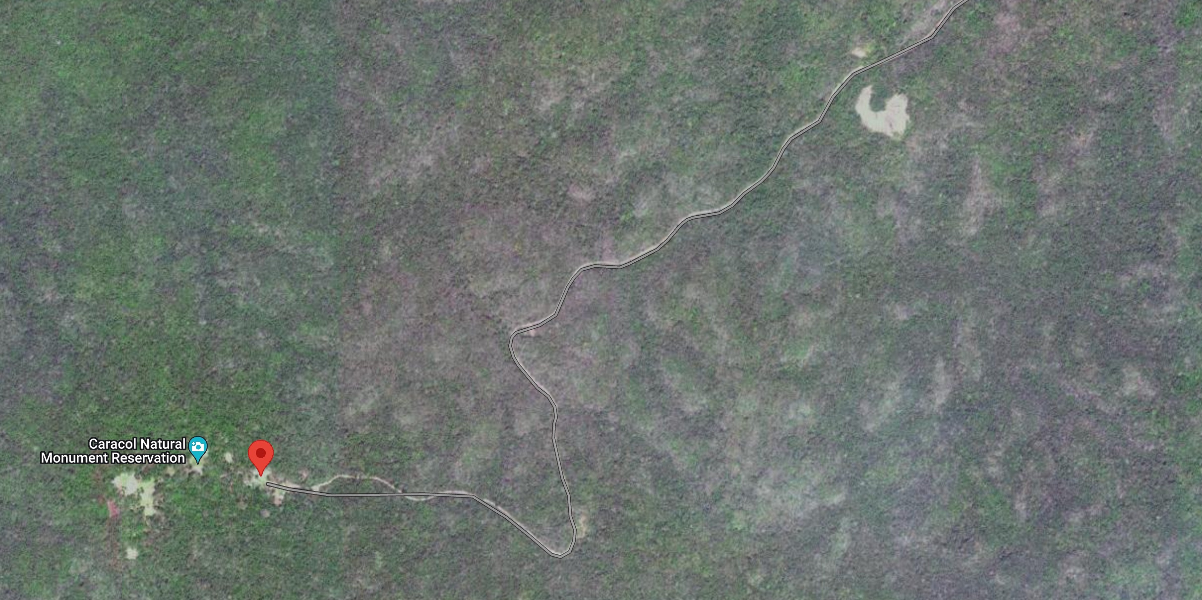
Caracol Archeological Site
When I saw the sign for the entrance to the site at last, I wanted
to get off the bike and dance. WE WERE HERE AT LAST. The grounds
were perfectly groomed, there was a multistory structure to the
left, where the staff lives, a covered picnic area, clean, tidy
bathrooms with flushing toilets next to it, a covered area with a
few artifacts and the building where you pay your entrance fee.
But no pyramids anywhere. The entrance fee was $15BZD / $7.50 USD.
Which is ridiculous. Belize, charge $20 USD per foreign visitor.
Even $25. Seriously.
There is no gift shop, no restaurant, not even water for sale - so
glad we brought snacks and water ourselves. This will all change
when the road is done.
The guard was happy to keep our motorcycle gear in his office. I
went to the bathroom to change from my motorcycle pants into my
much more light weight hiking pants and saw
a
hornets nest high up in the rafters. Thankfully, I did not
see any hornets.
It was starting to rain again, lightly. I didn't care. We were
about to see our first Mayan pyramids. If we were stuck there
overnight, so be it. There were three other vehicles in the
parking lot - I thought there would be more. But I guess not
everyone wants to schlep two and a half hours into the jungle to
look at Mayan ruins. We, however, lover of old rocks stacked on
top of each other, were here for it and giddy.
We had a look at
the
map on a sign at the start of the short hike, then began our
hike through a beautiful jungle landscape.
After several yards, to our right, we could see the main plaza up
ahead, with its pyramids all around.
We
reverently walked into the middle of it. It was lightly
raining. The smell of freshly-cut grass was everywhere. We were
alone in the plaza, standing before “Caana” or “Sky Place,” the
tallest man made structure in Belize.
I cried.
I cried when I saw the pyramids of Egypt the first time. I was
overwhelmed when I saw the the Teotihuacan Pyramids in Mexico.
Humans can do such magnificent things. I wish we devoted ourselves
more to such.
I made a quickie short video
to say more.
I'll leave it to you to go read about how tall and wide everything
is. All I know is, the site is SO big. So massive. All of the
structures, large and small, are a wonder of human achievement.
Like all Mayan sites, this was once a thriving metropolis. The
statistic you will hear frequently is that Caracol had a far
larger population than Belize City. And you will also frequently
read that this empire defeated the Tikal empire, and some say, the
conflicts between Guatemala and Belize are rooted that far back.
The Caracol site is MASSIVE, far more than you will see with your
eye. This has been revealed through the use of aircraft from the
National Center for Airborne Laser Mapping equipped with Light
Detection and Ranging (LiDAR) mapping tools. We LOVE NOVA and
other science shows on PBS, so we were up-to-date on the use of
LiDAR and its importance to archeology in Caracol specifically.
The site has been studied and visited extensively by Dr. Diane
Chase and her husband, Dr. Arlen Chase. They've been taking
archaeological field teams out to Caracol since 1985, a time when
the journey to the site was a two-day affair. If you spend any
time at all reading about Caracol, you will come across their
names over and over.
This
is my favorite article about them (great photos).
I knew I could not climb the Caana structure. So I waited and took
photos and made that short video
while
Stefan went up. We were all alone - the few other visitors
were elsewhere. We had the entire plaza to ourselves. There will
come a day when that is not possible, when you will not be able to
stand in this plaza alone, and when you cannot even walk up that
pyramid. We were so honored to have this moment. Eventually
looking up and seeing Stefan atop the pyramid, I was so jealous -
but also humbled. I thought of what it must have looked like at
night, the pyramids covered in stucco and colors, the holy people
probably carrying torches, the light show in full effect.
The sun came out. The rain had stopped.
It
was glorious.
All of these ruins were hidden for centuries by mounds of sediment
beneath a dense, old-growth rain forest. And most of the ruins
still are, and you can see the mounds all around, all these
thickly-covered structures. LiDAR allows researchers to see what's
under the growth in incredible detail, without uncovering it,
which would deforest an area the entire planet needs to be
forested and would also expose the structures to the elements -
the sediment protects them (though the tree roots tear them
apart).
Like other ancient sites, these were once covered in color, they
were not naked rock. We think of these structures looking just
like we see them back in the day, but that's rarely the case: they
were covered in stucco and painted. And, of course, there were
more stelas - standing stones - covered in glyphs all around. Who
knows what looters have spirited away from this site. And we also
don't know all that was destroyed by the Roman Catholic Church,
which burned all paper books and wooden religious images in great
bonfires, their efforts to completely erase Mayan religion.
We had no guide. Hiring a guide would have meant coming by a four
wheeled vehicle, not by the motorcycles. We
really wanted
to do this by motorcycle. I'm sure we missed so much as a result
of not having a guide - some stela or alter with glyphs that you
can only see because you have a guide that knows it's there. But I
think for our first visit to a Mayan site, we needed to just
wander around in wonder and awe. And that's what we did. We walked
the entire site with the exception of the residential complex
referred to as the Raleigh Group. We would have gone there had we
arrived earlier, but by the time we got back to the office, it was
almost 3, and everyone was supposed to have left by three. We'd
spent more than three hours at Caracol - with a guide and all of
our questions, that would have stretched out even more.
There was
a
line of shacks in an open field near one of the pyramids,
including shacks with primitive showers and maybe latrines (it
would have been quite a schlep up to the bathrooms at the
visitor's center). We're not sure who is staying there. Locals -
resident caretakers - that maintain the site? Archeologists and
researchers? We did see a Mayan woman preparing some food, but I
didn't want to bother her - she was very busy.
One last note about all the road construction: this isn't just a
paving project. This is a major road development that includes the
construction of eight bridges, one of them particularly massive
(as there's no bridge now, and it's the dry season, we rode under
it). The goal isn't just a tourist road to Caracol. The goal is
for an all-season road, even at the height of flooding season, so
that the entire area can be accessed easier by both tourists and
agricultural interests. The goal is also to firmly establish
people in the area, so that militant and bandit Guatemalans don't
make any more incursions into it, claiming it's theirs. Let's hope
that any archeological finds are being properly reported and
respected, and that there will remain a wide, wide area of jungle
all along the road and all around the actual site of Caracol.
As this paper from
the Chases and other researchers note:
A paved road will also provide access to the site
by cruise-ship passengers that dock in Belize City, as it will
make a day-trip by vehicle to Caracol a reality. This should
substantially escalate the visitors to the site and increase
the need to plan for the differentiation of visitor movement
and access at the site to best preserve the archaeological and
environmental resources.
There is a strong desire on the part of the Belize
Government to make Caracol a World Heritage Site. World
Heritage status would not only raise national pride in Belize
but would also help make Caracol more secure.
While Caracol remains a legally protected area by
virtue of being located in both a protected archaeological
reserve and a protected forest reserve, World Heritage status
would even more firmly establish the priorities of site
conservation as well as make more resources available to
enhance security for the general area.
The good news:
Learning from development at Tikal, Guatemala,
there is currently no intent to develop hotels within the site
itself. Future hotel development would likely take place in
Douglas de Silva, some 22 miles from the site epicenter.
Anyway, it was time for us to leave Caracol.
Though I was anticipating the road back, I wasn't dreading it - I
knew I could do it on the Honda 150. And I was pretty sure that I
could do it a bit faster on the way back because I knew what to
expect.
Eventually, we crossed what I guess is the Macal River - there had
been a large construction crew there earlier in the day that had
come in on a school bus, and I cannot imagine coming in on that
road on a school bus! We took a break on the other side of the
river, away from the parked construction equipment,
stopping
on a hill I never could have on my KLR. We took a pee break,
Stefan wondered where the KSK Dschungelcamp der Bundeswehr was
(the Germany military jungle camp apparently somewhere nearby,
according to online maps) and he had a smoke. It was quiet - no
sounds. Then we started up the bikes to push on. We came over the
hill, and... I saw so many black dots in circles, circles on dark
yellow, yellow that was glowing and moving quickly in the lush
green brush. The dots and the yellow were on a large body that
included a tail that looped up. It all disappeared into the
greenery.
What?
Oh my god.
I'd just seen a jaguar.
I started moving on the bike, pumping my fist, celebrating,
freaking out, elated as I rode on. Eventually we stopped, and I
almost yelled, "It was a jaguar! Did you see it? Did you see it?"
And he hadn't... I felt so bad. Stefan usually lets me be first,
because I'm slower, and he wants to make sure he can help if I
struggle. The downside of that arrangement is that I have to
sometimes deal with dear jumping in front of me. But the upside is
this.
Later, when we got back to the room, I looked up every big cat of
Belize on my phone, to make absolutely sure it couldn't have been
something else I'd seen, because people live their entire lives in
Belize and never see a jaguar (just as people live in Oregon and
never see a Mountain Lion - but if you hike a lot, they've seen
you...). But no, it was not a little margay or ocelot. I'll never
forget those dots and the size and that dark, glowing yellow.
The military compound hut was empty by the time we were back, but
the log book was still there. The gun wasn't. Stefan took
a
photo of the log book, and we signed out - noting that,
indeed, we'd been the last ones to go to the site. I wonder at
what point they would have come looking for us?
Soon after we left, we came over the hill and into the valley
where it had rained so much earlier, and I was stunned that, just
like all of the ride back so far, the dirt was nicely hard packed
and relatively dry. However, I was also stunned to see three
people in what I thought was military camouflage walking on the
road and thought, oh, shit, the Guatemalan bandits are back and
we're about to get robbed! But then I saw two had surveyor
equipment and I calmed down. As we passed the forest reserve
office, we had to slow down because of a trucking coming our way,
and a guy - part of the construction team, I guess - high up on
the ridge at the office started cheering and clapping for us.
Yeah, that's right, we're bad asses, woooo!
Yes, even at this late hour, there was still construction going on
the road.
We went back a slightly different way once we were back on
pavement, straight back to the Western Highway instead of through
San Antonio, on the newly constructed and oh-so-excellent road. We
saw the sign for the Barton Creek Archeological Site - I'm not
sure why we didn't stop. However, later having looked it up
online, we never could have made it before closing time. The ride
was really nice though back this different way and I enjoyed
seeing all the Mennonites in their horse-pulled carts.
What makes them Mennonites and not Amish, by the way? After all,
so many of them wear beards and the men are as restricted in how
they dress as the women, and so many eschew from modern
technologies. A lot of people think the difference in Mennonites
and Amish is that Mennonites aren't as strict as the Amish about
how they dress, about using cars, etc. But while that's often a
difference you see, it's NOT the fundamental difference in these
groups - it's not what makes one group Amish and another
Mennonite. Originally, there were no Mennonites or Amish; there
were only Anabaptists. Anabaptists are also the spiritual ancestor
of Baptists and Quakers. I was raised Baptist - that's probably
why I have such an affinity for Mennonites. In sixteenth-century
Holland (that means the 1500s), a man named Menno Simons joined
the Anabaptists and became prominent among them. About a century
after Simons, a Swiss Anabaptist named Jacob Ammon began to preach
that the Anabaptists were not following their founding principles
closely enough, and the followers of his ideas became known as
Amish and separated from the other Anabaptists. The remaining
Anabaptists became known as Mennonites after Menno Simons. The
people you see in Belize are followers of Menno Simons - they are
Mennonites - and some live with modern things like cars and
phones, while some live much more simply and without mechanical or
electrical technoogy. The Wikipedia entry about Mennonites in
Belize gives
a
great description of just how diverse the Mennonites are there.
We were back at the hotel before dark, inspired but tired. What a
day. What an experience. I told all at the staff what we had just
done: we went to Caracol by motorcycles and on the way out, I saw
a jaguar. I wanted to tell THE WORLD. So many Belizeans told me
that it was an honor to see such, that they had never seen such.
And I felt humbled. Although one of the Midas receptionists HAS
seen a jaguar and we got all excited talking about how that yellow
is SO BRIGHT and yet not at all a sunny yellow - it's an
orange-ish yellow.
There was, however, a casualty that day: Stefan's hiking boots.
Stefan had rarely worn those boots,
as
you can see from the almost perfect treads. But they are
about 20 years old.
And
they were now about to come completely apart in the heels.
We were horrified. He used zip ties to repair them temporarily,
but how long would THAT last? Yikes!
I kept making jokes about a guy who had derided our trip
beforehand. He'd said he had heard it was very flat and warned,
"Don't expect fun roads for bikes!" Wow, he was so, so wrong.
I checked in via WhatsApp with Elmer, the guide I had booked for
Tikal when I was back in the USA, and then asked the Midas staff
what time she thought we should head to the border. She said there
wasn't a need to book a cab in advance - just come up front about
30 minutes before we were ready to leave and she would call
someone, and she told us the price. And Midas oh-so-generously
allowed us to keep my bag, our pants, our jackets and our helmets
there. In fact, we kept them all neatly stacked in the corner of
our room, in case they needed to rent the room the night we were
gone and needed to move our stuff elsewhere. I just really cannot
say enough sweet things about the staff there.
Stefan also had a new proposal: why stay at Midas two more nights
after we got back from Tikal? Why not just one night, and then
stay a night at Warrie Head? I'd been talking about how much I'd
love to stay there just one night. The price wasn't much more than
Midas. We could go to the Mayan sites of Xunantunich and Cahal
Pech, sleep at Warrie Head that night after those visits, and then
head North to Lamanai the next day. I thought it was a great idea,
so I booked a room online, directly on the site.
We
swam
in the pool that night after our very intense day. I looked
up at the stars as I floated, and thought about the Mayans of
those earlier days looking up at these stars. I thought about how
lucky I am. I thought about what an incredible person Stefan is
and how grateful I am to have him in my life. I thought about how
I wish everyone loved history this much, so much they wanted to
preserve it and share it respectfully. I thought about how this
trip was already everything I wanted it to be.
And we weren't even half done.
Part 4 of
our trip: Guatemala and Tikal (sans motorcycles).
You can see
my
favorite photos from our trip here (there are about 500 and
most are taken by me or feature ME). You can
see Stefan's
favorite photos from the trip here (there are about 800 and
most are taken by him or feature him).
Return to the
main
page for our Belize and Guatemala 2023 Adventure.

 Are you a woman? (however
you define that, I don't care). Have you traveled somewhere and
want to talk about it? Have a travel blog? Have an online album
of photos from your trip that you want to share? Have a tip for
travelers? You can post links to your blog at r/womenwhotravel,
an online discussion group on Reddit (a subreddit). Unlike other
women and travel subreddits and many other online communities,
this group DOES allow people to post links to their blogs,
YouTube channels, etc., so long as it's either focused on women
and travel or is by a woman who travels. Whether you are a
backpacker, a bicycle traveler, a budget traveler, a luxury
traveler, an adventure traveler, a cruiser, and whether its a
weekend getaway or some epic experience in another country, come
share your experiences at r/womenwhotravel.
And if you are an experienced traveler, join the group and help
answer questions from newbies. There's just one thing this group
doesn't allow: the question "Is such-and-such area safe."
Because that question is impossible to answer.
Are you a woman? (however
you define that, I don't care). Have you traveled somewhere and
want to talk about it? Have a travel blog? Have an online album
of photos from your trip that you want to share? Have a tip for
travelers? You can post links to your blog at r/womenwhotravel,
an online discussion group on Reddit (a subreddit). Unlike other
women and travel subreddits and many other online communities,
this group DOES allow people to post links to their blogs,
YouTube channels, etc., so long as it's either focused on women
and travel or is by a woman who travels. Whether you are a
backpacker, a bicycle traveler, a budget traveler, a luxury
traveler, an adventure traveler, a cruiser, and whether its a
weekend getaway or some epic experience in another country, come
share your experiences at r/womenwhotravel.
And if you are an experienced traveler, join the group and help
answer questions from newbies. There's just one thing this group
doesn't allow: the question "Is such-and-such area safe."
Because that question is impossible to answer.